About
Reality capture is not about the scanner. It’s about understanding the entire workflow.
I’m Roland Kriston, a Reality Capture & Geospatial Specialist with more than 15 years of hands-on experience across 3D laser scanning, point clouds, spatial documentation and geospatial data workflows.
Over the years, I have worked across different project environments, technologies and stages of the reality capture process from field data acquisition and registration to georeferencing, point cloud processing, optimisation, QA/QC and spatial deliverables.
That experience shaped the way I work today.
I do not see reality capture as a collection of separate tools.
I see it as one connected workflow.
The site.
The project objective.
The technology.
The captured data.
The processing.
The final deliverable.
Every decision made at one stage affects what happens next.
That wider perspective is at the core of RdesignR.
Experience across the full reality capture workflow.
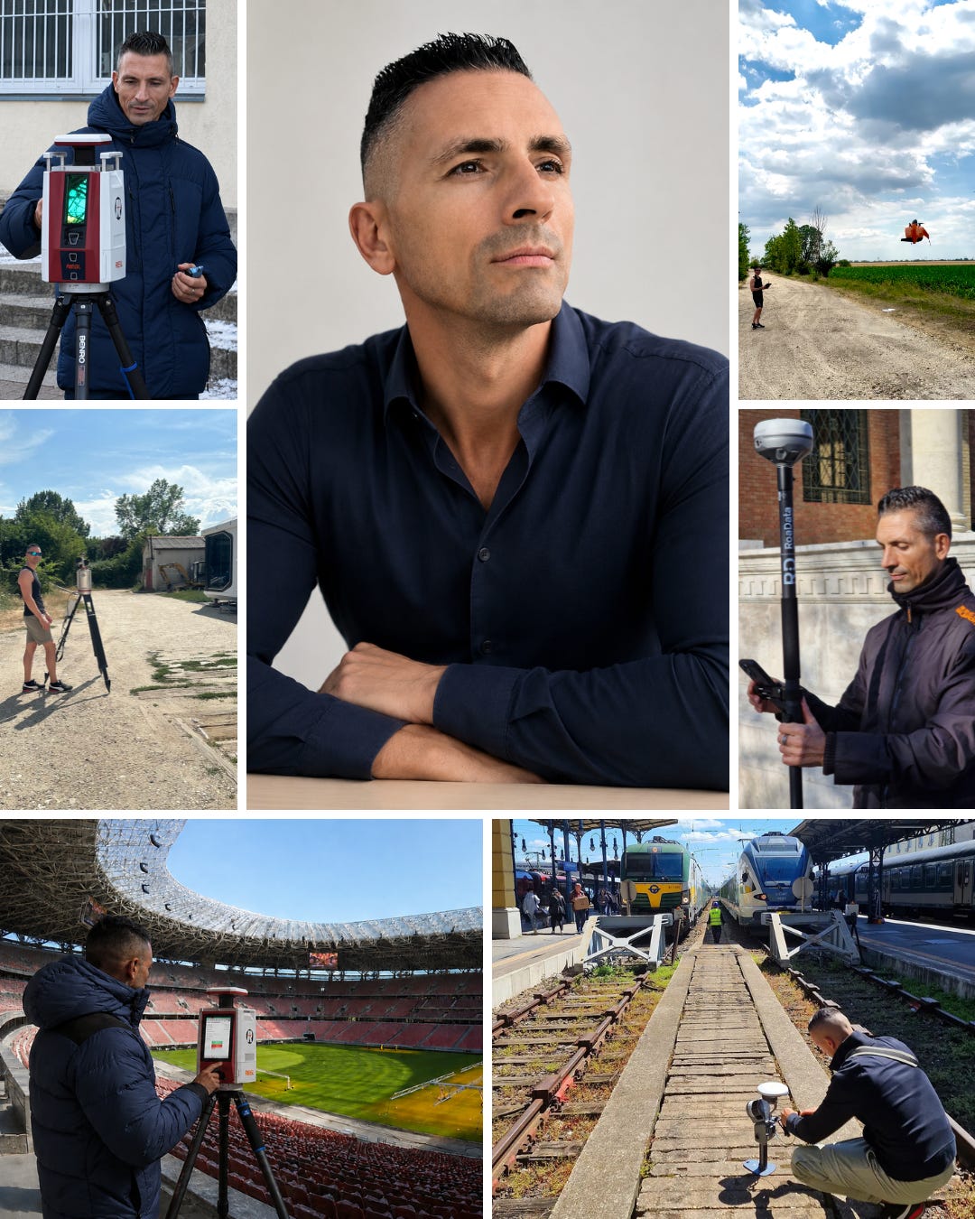
My professional experience has developed across both fieldwork and data processing.
I have worked with:
Terrestrial laser scanning
Mobile mapping
GNSS-supported workflows
Point cloud registration
Georeferencing
Point cloud cleaning and optimisation
Large dataset organisation and handling
QA/QC
Spatial documentation
Mesh and 3D spatial model workflows
Multi-technology reality capture projects
This has given me experience on both sides of the process:
what happens in the field
and
what happens to the data afterwards.
That connection matters.
Field decisions affect processing.
Processing decisions affect data quality.
Dataset structure affects usability.
And the way spatial data is prepared influences what the next team can do with it.
Different environments. Different challenges.
Over the years, I have contributed to projects involving:
Built environments
Buildings and technical facilities
Large-scale spatial documentation
Cemetery mapping
Educational facilities
Energy assessment support
Tourism and visitor environments
Public and municipal assets
Complex point cloud datasets
Multi-site projects
Reality capture and geospatial workflows
Every environment creates a different set of technical and operational challenges.
A building requires a different capture strategy from a large outdoor site.
A technical facility creates different constraints from a public environment.
A dataset intended for engineering use may need to be handled differently from one created for visualisation or documentation.
This variety has shaped a simple principle in the way I approach projects:
understand the problem first, then build the workflow around the required outcome.
More than technology
Reality capture is often presented through equipment specifications.
Accuracy.
Range.
Speed.
Points per second.
Positioning performance.
These numbers matter.
But they do not tell the whole story.
A technically advanced system can still be the wrong tool for a project.
A fast capture workflow can still create unnecessary processing complexity.
A visually impressive point cloud can still be unreliable.
And a perfectly processed dataset can still fail if it does not meet the requirements of the next stage.
That is why I try to look beyond individual technologies.
The real question is not:
Which scanner should we use?
The better question is:
What does the project need, and what combination of technology, workflow and expertise will deliver it reliably?
Why RdesignR?
I created RdesignR as an independent professional practice built around specialist expertise, practical experience and the requirements of each project.
The model is intentionally simple.
Some projects need additional point cloud processing capacity.
Some need specialist technical support.
Some require hands-on field experience for a defined assignment.
And some require different technologies or additional specialist input depending on the project requirements.
For remote projects, I support existing reality capture workflows with point cloud processing and technical expertise.
For selected field assignments, I can work with client- or partner-provided equipment in Hungary and across Europe.
Where a project involves additional technical requirements, I can work alongside clients, project partners and other specialists within the wider project workflow.
The project defines the technology — not the other way around.
How I work
I value straightforward technical collaboration.
Understand the objective.
Clarify the available data and project conditions.
Define what is needed.
Build the right workflow.
Deliver what the next stage of the project requires.
I can work independently on a clearly defined task or integrate into an existing technical team where additional experience or specialist support is needed.
My role is not to make the workflow more complicated.
It is to help move the project forward.
RdesignR today
Today, I work through RdesignR as an independent Reality Capture & Geospatial Specialist, supporting projects remotely and on-site.
My primary focus is:
🟠 Point Cloud Processing & Reality Capture Support
Remote point cloud processing and specialist technical support for surveying, geospatial and reality capture teams.
🟠 Reality Capture Data Acquisition
Project-based data acquisition and specialist field support for selected assignments in Hungary and across Europe.
Alongside client work, RdesignR is also where I document the projects, technologies and lessons behind my work.
Selected Projects
Real projects are the best way to understand how I work.
The Projects collection explores selected reality capture and spatial data projects, including the technical challenges, workflows and decisions behind them.
Field Notes
Field Notes is where I share practical observations, technical insights and lessons from working with reality capture technologies, spatial data and geospatial workflows.
Technologies & Workflows
The Technologies section explores the tools, methods and technical workflows behind my work from terrestrial laser scanning and mobile mapping to point cloud processing, registration, georeferencing and spatial deliverables.
EXPLORE TECHNOLOGIES & WORKFLOWS → (coming soon)
Let’s work together.
If your team needs experienced point cloud processing, specialist reality capture support or project-based data acquisition for an upcoming assignment, let’s talk.
We can start with one project.