Reality Capture Data Acquisition
Experienced Reality Capture. Built Around Your Project.
Through RdesignR, I provide project-based reality capture data acquisition and field support for surveying, geospatial, engineering and reality capture teams that need experienced specialist support on site.
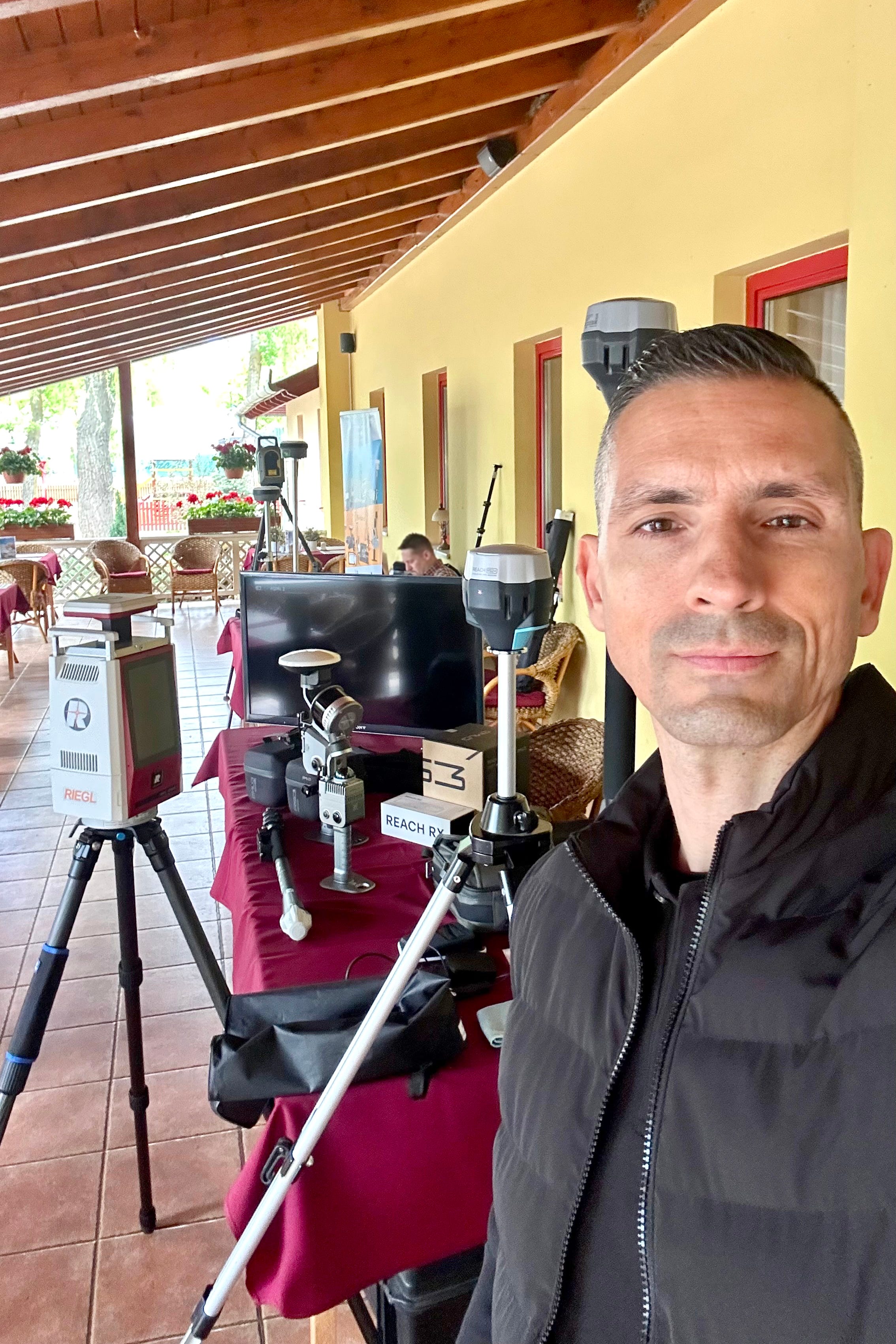
I can join existing project teams for data acquisition, site documentation and reality capture fieldwork, working with client- or partner-provided equipment and established project workflows.
Available for selected assignments in Hungary and across Europe.
On-site · Project-based · Hungary & Europe
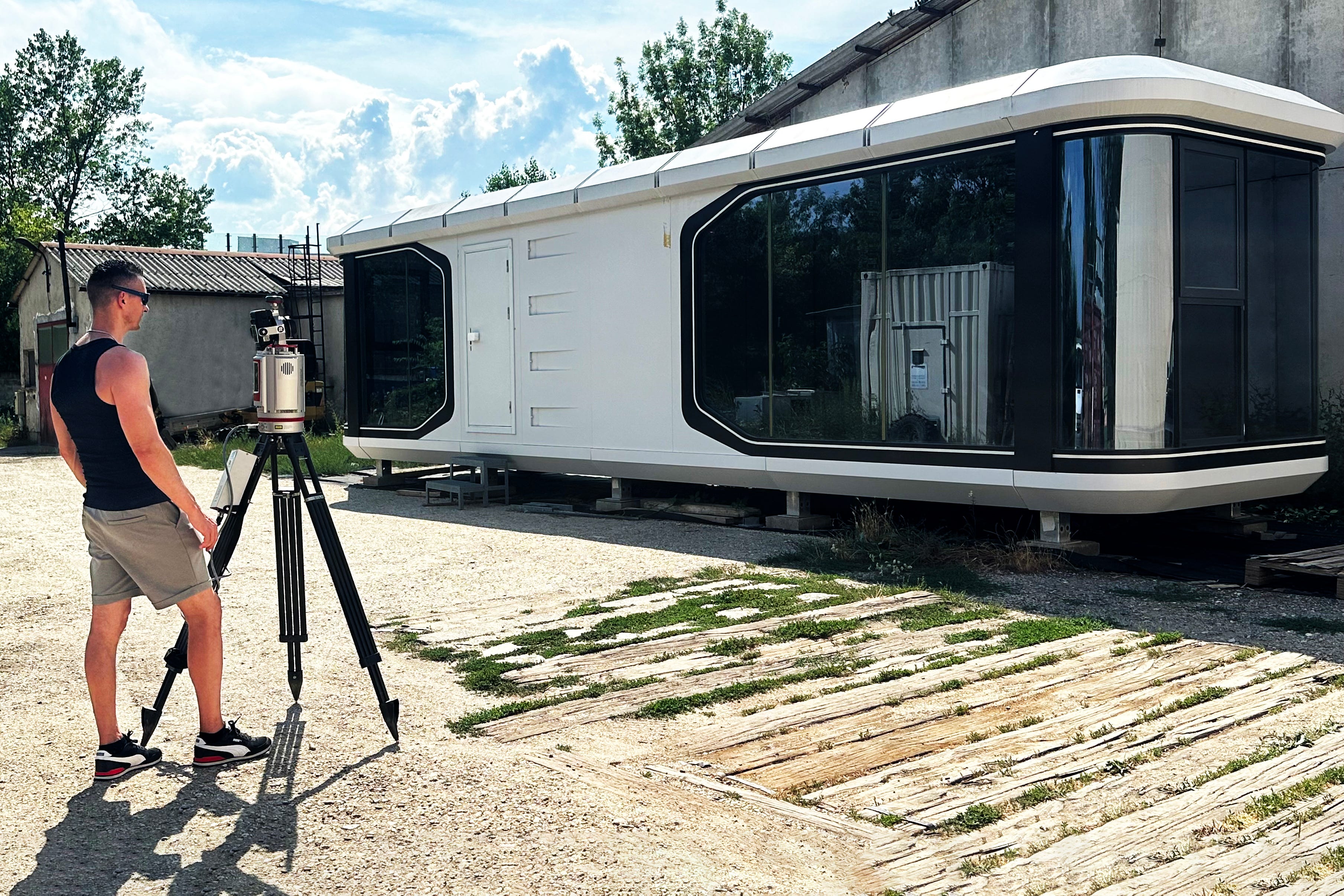
When your project needs experienced field support
Reality capture projects do not always require another permanent team.
Sometimes you need an experienced specialist for a specific assignment.
Additional specialist support during an intensive data acquisition phase.
Someone who can join an existing field team.
Support for a multi-site project.
Additional capacity for a project in Hungary or elsewhere in Europe.
Or a specialist who understands not only how spatial data is captured, but what needs to happen to that data afterwards.
That is where I can step in.
Through RdesignR, I am available for selected project-based data acquisition and field assignments where additional reality capture experience and technical expertise are needed.
I join the project where my experience can add value without the need to build permanent additional capacity around a temporary requirement.
How I can support your project
Depending on the assignment, field support may include:
Terrestrial laser scanning
Mobile mapping
GNSS-supported workflows
Reality capture fieldwork
Site documentation
Data acquisition support
Data acquisition planning support
Field data organisation
Multi-technology capture workflows
Project-specific reality capture support
The exact scope depends on the project requirements, site conditions, available technology, expected deliverables and the wider project workflow.
I can work independently within a clearly defined scope or integrate into an existing field or technical team.
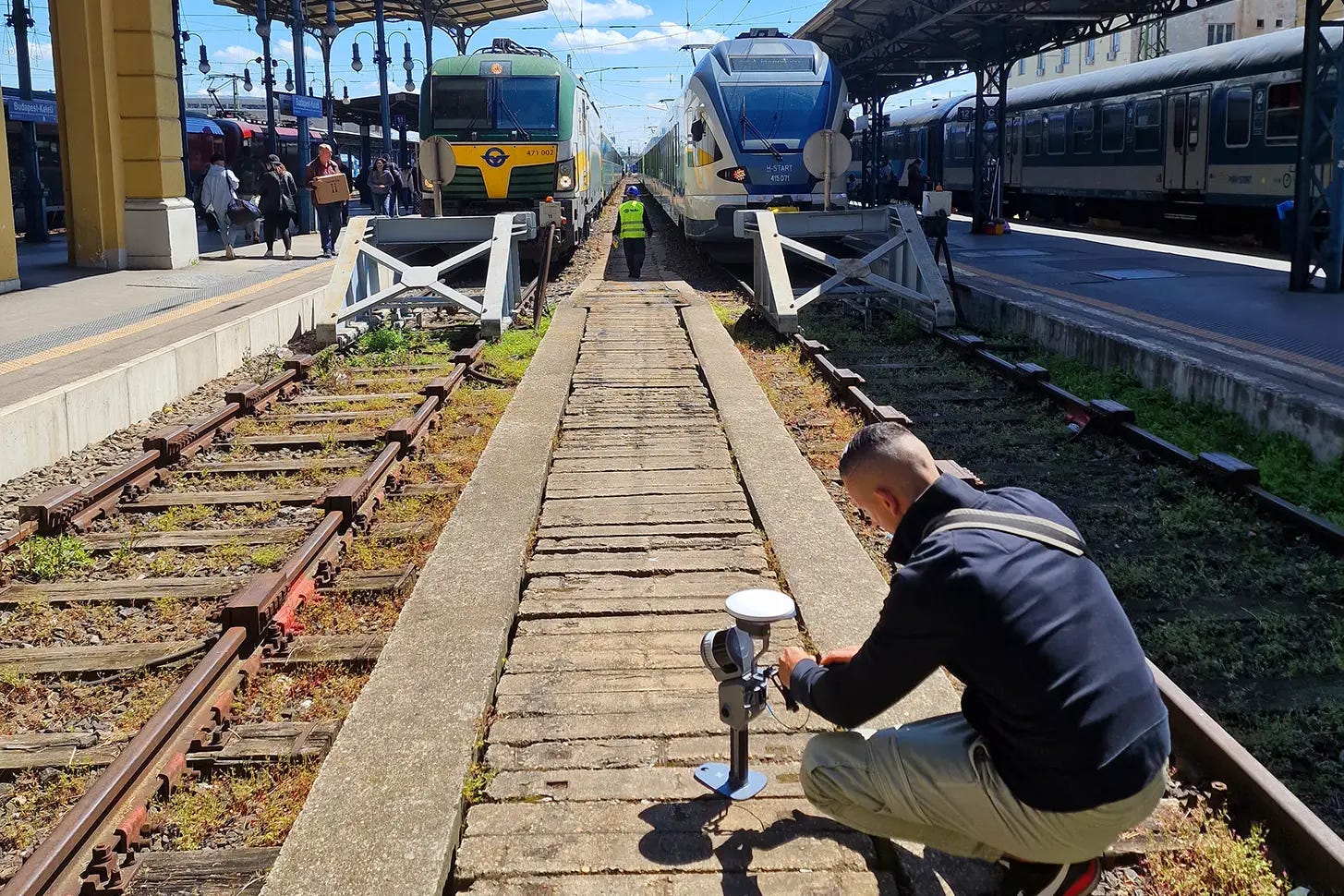
Built around the project. Not around a fixed equipment inventory.
RdesignR is not built around a fixed fleet of reality capture equipment.
This is intentional.
Different projects require different technologies.
A terrestrial laser scanner may be the right solution for one environment.
Mobile mapping may provide a more efficient workflow for another.
GNSS may be required to connect the captured data to a wider spatial reference.
And some projects benefit from combining multiple technologies.
For field assignments, I can work with client- or partner-provided equipment, allowing the technical setup to be selected according to the actual requirements of the project.
This creates a flexible approach:
the project defines the technology — not the other way around.


Where additional field expertise can add value
🟠 Additional Project Capacity
For projects where your existing team needs an experienced additional specialist for a defined period.
🟠 Multi-Site Projects
For projects involving multiple locations where additional field capacity can help maintain an efficient acquisition schedule.
🟠 Peak Workloads
For periods when several projects overlap and your permanent field resources are already committed.
🟠 Local Project Support
For international companies delivering projects in Hungary or the wider region that need experienced reality capture capacity closer to the project location.
🟠 Specialist Assignments
For projects where specific reality capture or geospatial workflow experience is needed alongside an existing team.
🟠 Technology Partner Projects
For reality capture technology companies, distributors and resellers that need experienced field support for customer projects, demonstrations, technical assignments or project-specific workflows.
Who I work with
Reality Capture Data Acquisition is designed primarily for professional teams operating within surveying, geospatial, engineering and reality capture environments.
This may include:
◉ Reality Capture Companies
Additional experienced field capacity for individual projects or periods of increased workload.
◉ Surveying & Geospatial Companies
Reality capture and data acquisition support integrated into existing survey and geospatial workflows.
◉ Engineering & Technical Teams
Project-specific support for spatial documentation and reality capture assignments.
◉ Construction & Built Environment Projects
Reality capture field support where spatial documentation is required as part of a wider project workflow.
◉ Technology Companies & Distributors
Independent specialist support for demonstrations, customer projects, pilot workflows and project-based technical assignments.
◉ International Project Teams
Local or regional specialist capacity for projects taking place in Hungary or, depending on the assignment, elsewhere in Europe.
Fieldwork is part of a larger workflow
Capturing spatial data is not an isolated task.
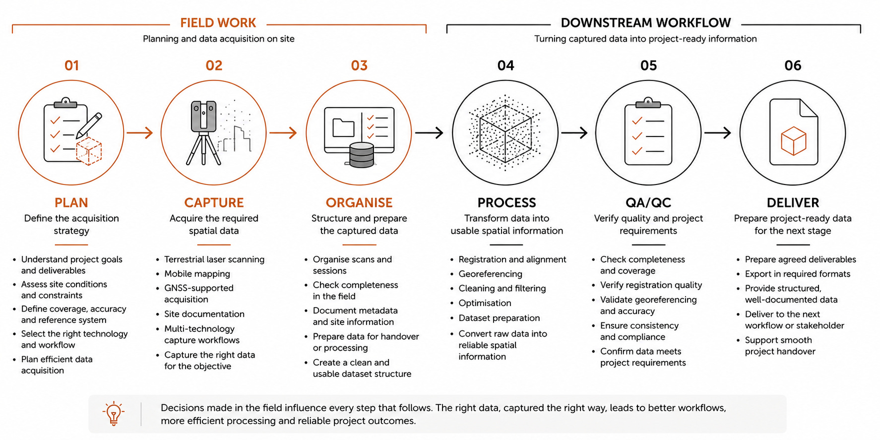
Decisions made in the field affect everything that happens afterwards.
Scanner positioning affects coverage.
Coverage affects registration.
Field procedures influence data quality.
Positioning affects georeferencing.
Dataset organisation influences processing efficiency.
And the quality of the captured data ultimately affects the usefulness of the final deliverable.
My experience across both field acquisition and point cloud processing allows me to approach fieldwork with the downstream workflow in mind.
The objective is not simply to capture as much data as possible.
It is to capture the right data in a way that supports what needs to happen next.
How we work together
Project Overview ⟶ You share the location, project requirements, expected scope, available equipment, project timeline and required deliverables.
Technical Setup ⟶ We clarify my role within the project, the technology and equipment being used, the field workflow and responsibilities within the wider team.
Field Assignment ⟶ I join the project for the agreed assignment and work independently or alongside your existing field team.
Data Handover ⟶ Captured data is organised and handed over according to the agreed project workflow.
Processing Support, if required ⟶ Where relevant, I can continue supporting the project remotely through point cloud processing or technical reality capture support.
This creates continuity between what happens in the field and what happens to the data afterwards.
From fieldwork to processing
One advantage of working across both field and processing workflows is the ability to support a project beyond the site itself.
Where required, field assignments can connect directly with my remote:
Point cloud registration
QA/QC
Point cloud cleaning and optimisation
Georeferencing support
Dataset preparation
Processing troubleshooting
This does not mean every field project needs to include processing support.
The two services can be used independently.
But when continuity is valuable, the same specialist can remain involved as the project moves from data acquisition to data processing.
For dedicated remote processing support, see:

Experience across different project environments
Over the past 15+ years, I have worked across a range of reality capture and spatial documentation environments, including:
Built environments
Buildings and technical facilities
Large-scale sites
Cemetery mapping
Educational facilities
Tourism and visitor environments
Public and municipal assets
Spatial documentation projects
Multi-technology reality capture workflows
Different environments create different constraints.
Access.
Scale.
Time.
Coverage.
Positioning.
People.
Weather.
Technology.
The field rarely behaves exactly like the plan.
Experience helps adapt the workflow without losing sight of the project objective.
What this service does not include
To keep the scope clear, Reality Capture Field Support does not automatically include:
Provision of scanning equipment as part of the standard service
Equipment rental
Certified land surveying
Legal cadastral surveying
Engineering certification
Architectural or engineering design
Full Scan-to-BIM production
Travel and accommodation costs for assignments outside the agreed local project area
Equipment requirements, travel, accommodation and project-specific expenses are agreed separately before the assignment.
Where certified surveying or other regulated professional services are required, these need to be provided by the appropriately qualified project partner.
Availability
Reality Capture Data Acquisition is available for selected project-based assignments in Hungary and across Europe.
Hungary
Available for local and national projects requiring experienced reality capture expertise, data acquisition or specialist field support.
For international teams delivering projects in Hungary, I can also join an existing project team as a local reality capture specialist, working within the established technology and project workflow.
Europe
Available for selected international assignments where the project scope, location, duration and technical requirements make on-site specialist involvement appropriate.
Each international assignment is considered individually to ensure that the proposed involvement, technology and workflow are appropriate for the project.
Need experienced reality capture support on site?
If your team has an upcoming reality capture project and needs an experienced specialist to join the field workflow, let's talk.
Share the project location, expected scope, technology and timeline, and we can explore whether I am the right fit for the assignment.