Mobile Laser Scanning for Digital Cemetery Mapping
Transforming complex cemetery environments into georeferenced, platform-ready point clouds and intuitive 3D spatial representations.
CASE STUDY · REALITY CAPTURE
PROJECT OVERVIEW
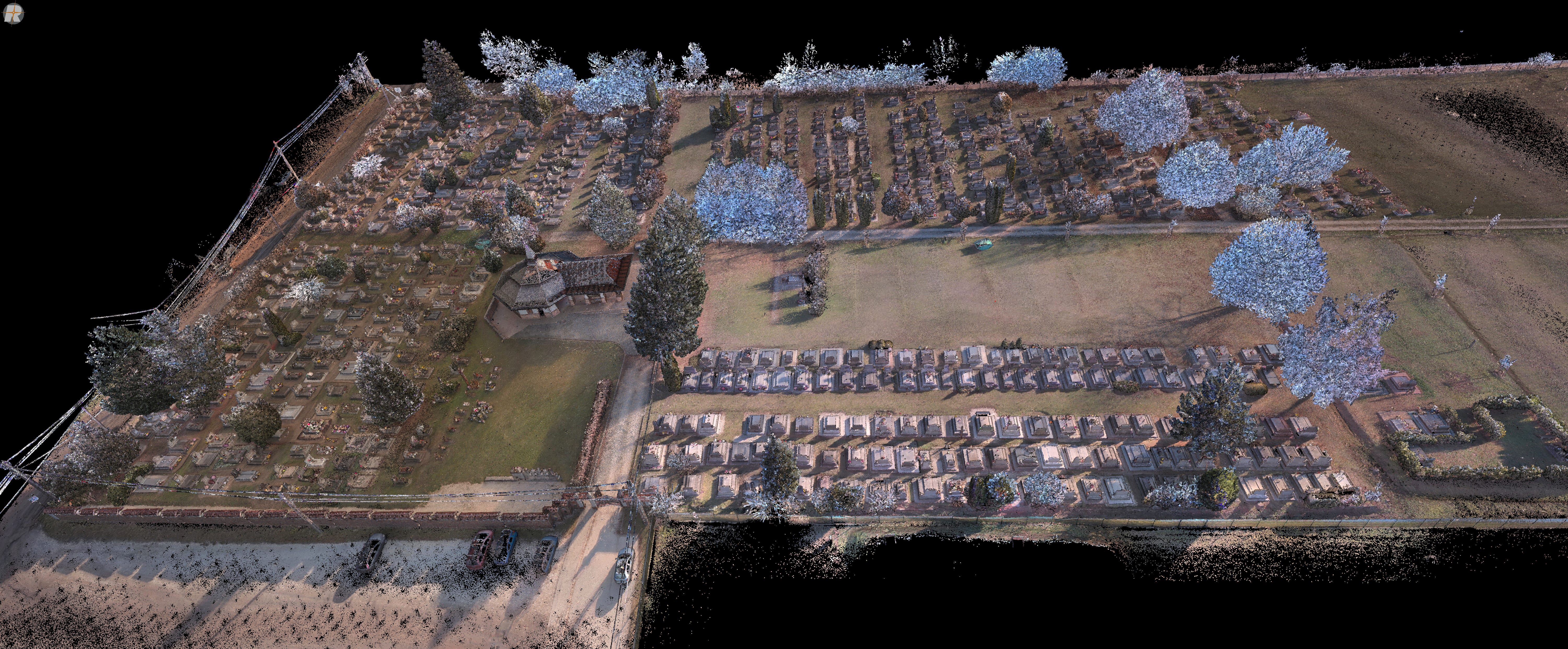
Three municipal cemetery sites across two rural municipalities in Hungary were digitally documented to support cemetery mapping and the online registration of burial plots.
I worked as part of a two-person project team in collaboration with RoaData Kft., contributing to both field acquisition and the downstream point cloud workflow.
Multiple mobile scanning trajectories had to be processed, registered, georeferenced, cleaned and optimised into unified datasets suitable for the target cemetery management environment.
PROJECT TYPE: Municipal Spatial Documentation
MY ROLE: Capture · Processing · Registration · Georeferencing · QA/QC
OUTPUT: Platform-Optimised Point Clouds · 3DGS
COLLABORATION: RoaData Kft.
THE CHALLENGE
Cemetery environments contain dense and irregular geometry. Narrow pathways, mature vegetation, monuments and closely positioned graves create significant occlusion during mobile data capture.
The project also introduced processing challenges. Independently captured parcels required sufficient overlap for reliable registration, while the final point clouds had to maintain geometric detail and positional accuracy within the technical limitations of the target platform.
The challenge was therefore not simply to capture as much data as possible, but to create spatial datasets that were accurate, coherent and usable for their intended application.


MY ROLE
I worked as part of a five-person project team in collaboration with RoaData Kft., covering both assigned field acquisition and downstream point cloud processing.
My responsibilities included mobile scanning, trajectory overlap planning, point cloud cleaning, parcel integration, registration in RiSCAN PRO, GNSS-supported georeferencing refinement, colourisation, point density optimisation and final QA/QC.
My involvement therefore extended from field capture through to the preparation of project-ready spatial datasets.
THE TECHNICAL APPROACH
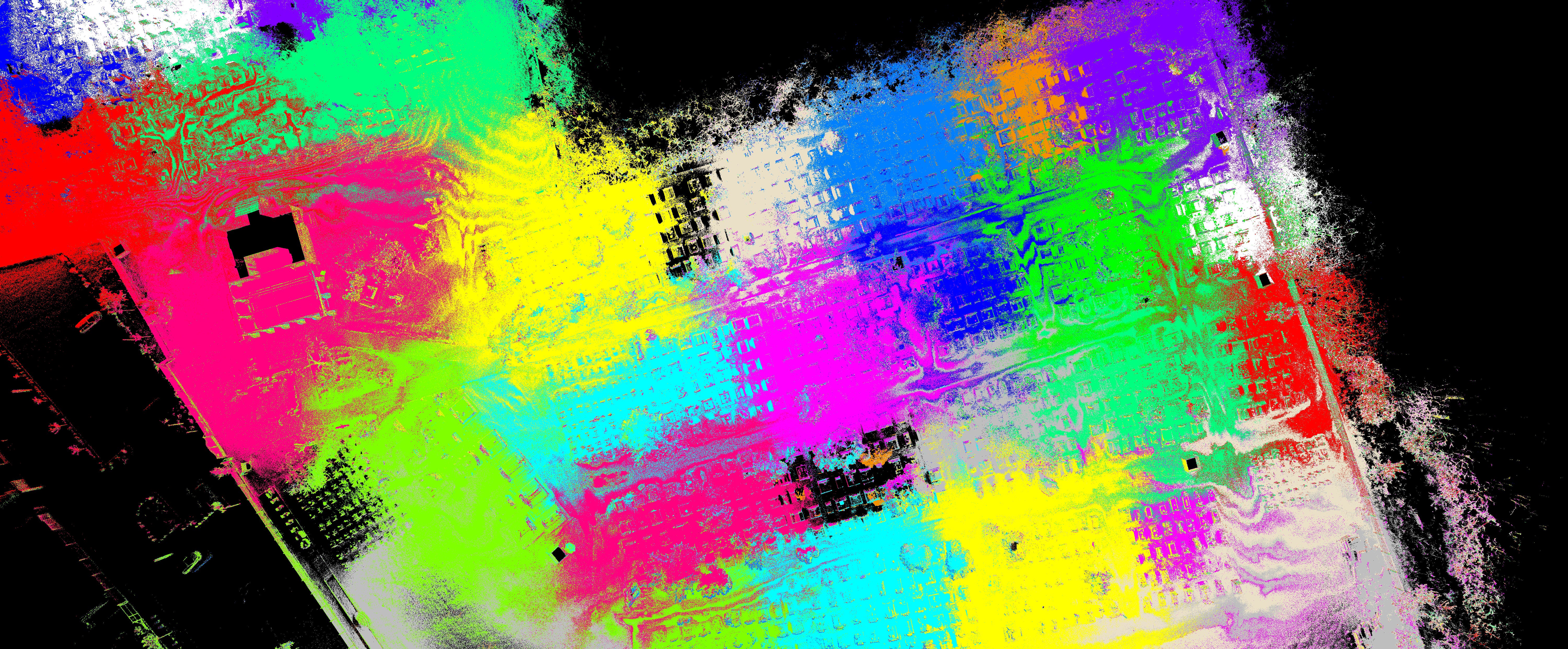
Each cemetery was divided into smaller survey parcels and captured using handheld mobile laser scanning.
Because the workflow relied on continuous trajectories rather than fixed scan positions, sufficient overlap between neighbouring survey areas was essential for reliable downstream registration.
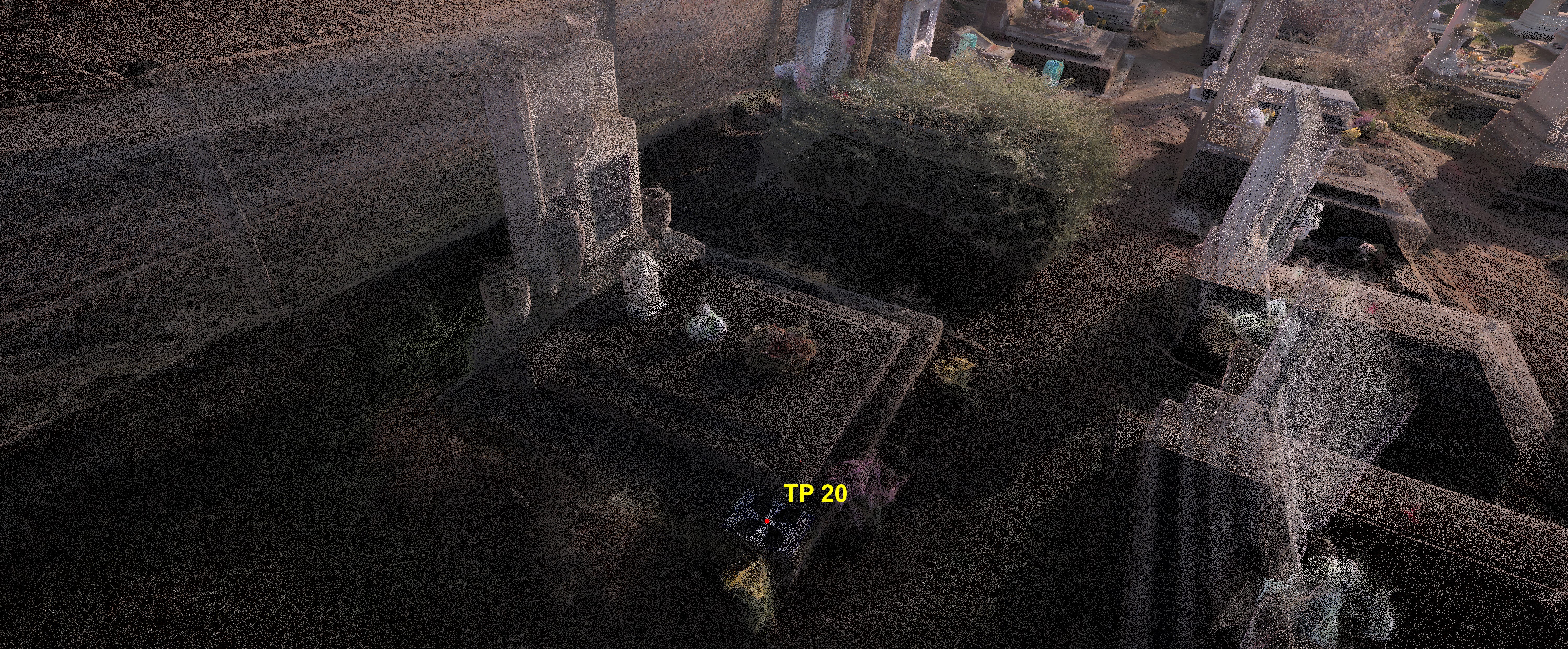
GNSS-measured control points provided an independent spatial reference for refining scanner-derived EOV coordinates.
The capture strategy was therefore designed around the requirements of the processing workflow:
Capture → Maintain Overlap → Establish Control → Register → Georeference
Dense vegetation and narrow spaces required slower, more deliberate scanning trajectories. The same conditions increased downstream cleaning effort by generating significant unwanted point cloud data around burial plots.
POINT CLOUD PROCESSING
Individual trajectories were processed in Lixel Studio and transferred to RiSCAN PRO for registration and integration. Overlapping geometry between neighbouring survey areas supported alignment, while GNSS control points were used to refine the scanner-derived EOV coordinates.
Processing → Cleaning → Alignment → Registration → Georeferencing → Colourisation → Optimisation → QA/QC
The objective was to transform independent scan datasets into coherent, project-ready spatial data.
DATA OPTIMISATION FOR THE TARGET PLATFORM
The completed point clouds contained more data than the target platform could efficiently process. The datasets were therefore filtered and downsampled while preserving the geometry required for practical documentation.
Approximately 1 TB of processed point cloud data was handled across the project.
The highest possible point density is not always the most useful deliverable.


ADDITIONAL 3D VISUALISATION
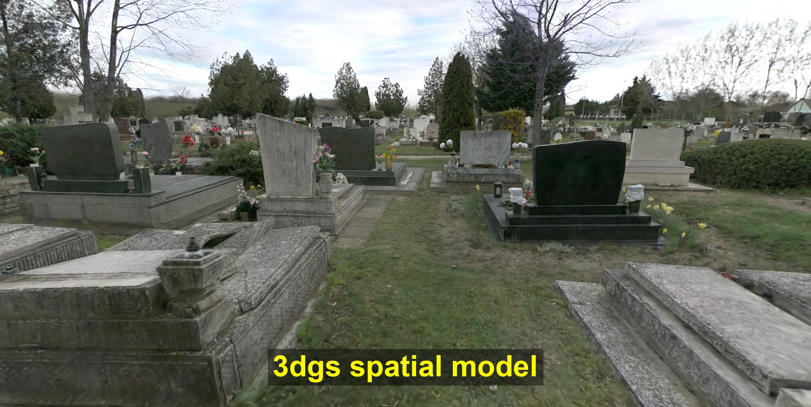
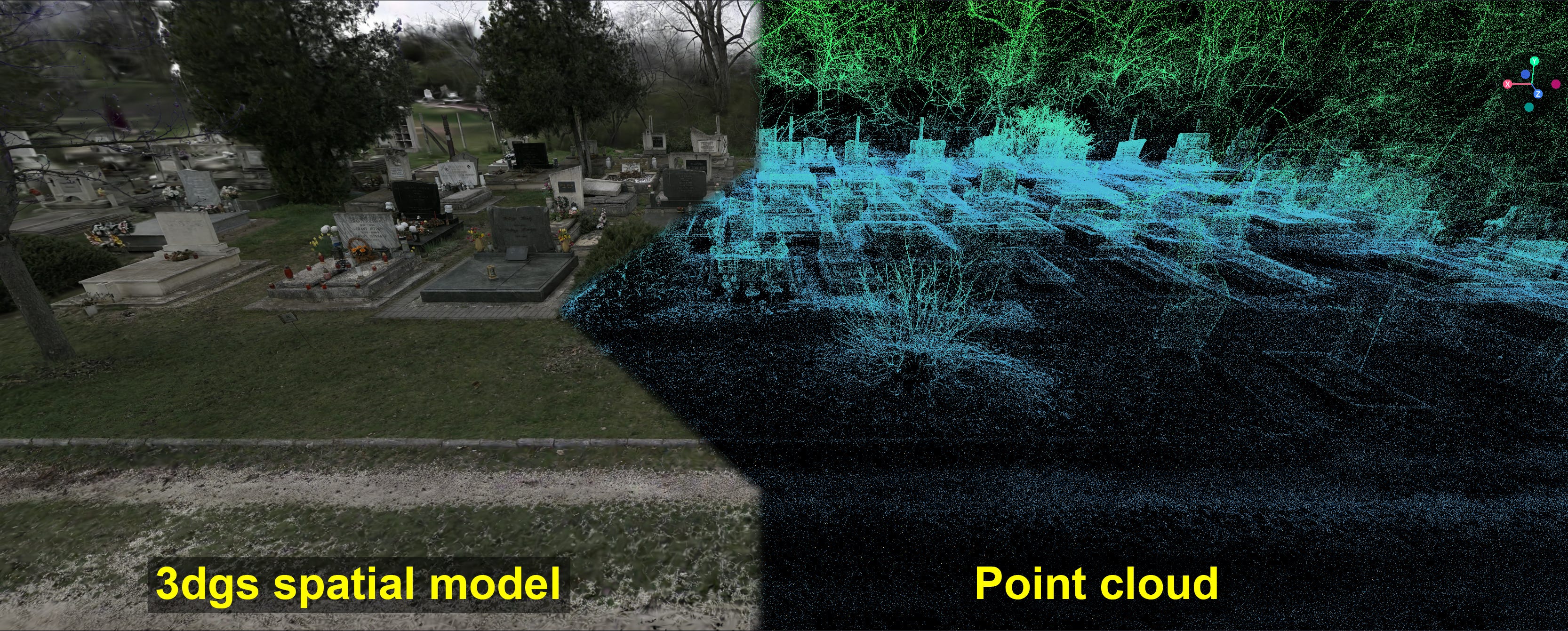
Selected environments were also represented using 3D Gaussian Splatting (3DGS).
While point clouds remained the technical reference dataset, 3DGS provided a more intuitive visual layer for non-technical stakeholders.


THE OUTCOME
The workflow transformed multiple independent mobile scanning trajectories into unified, georeferenced and platform-optimised spatial datasets.
Registered and integrated point clouds
Cleaned and colourised datasets
EOV georeferenced data
Platform-optimised point clouds
3DGS visualisations
WHAT THIS PROJECT DEMONSTRATES
This project demonstrates that reality capture value is created not only during field acquisition, but during the processing stages that follow.
Registration, cleaning, georeferencing, QA/QC and optimisation were essential to turn fragmented scan data into reliable, project-ready datasets. This is directly relevant to teams that already have captured data but need specialist processing capacity.
TECHNOLOGY USED
Hardware
Lixel L2 PRO · Emlid Reach RX2 · Emlid Reach RS4
Software
Lixel Studio · RiSCAN PRO
Methods
Mobile Laser Scanning · GNSS Georeferencing · Registration · Optimisation · QA/QC · 3DGS
Survey equipment provided within the RoaData Kft. project collaboration.
WORKING WITH COMPLEX POINT CLOUD DATA?
I provide project-based and ongoing support for registration, cleaning, georeferencing, optimisation, QA/QC and dataset preparation.